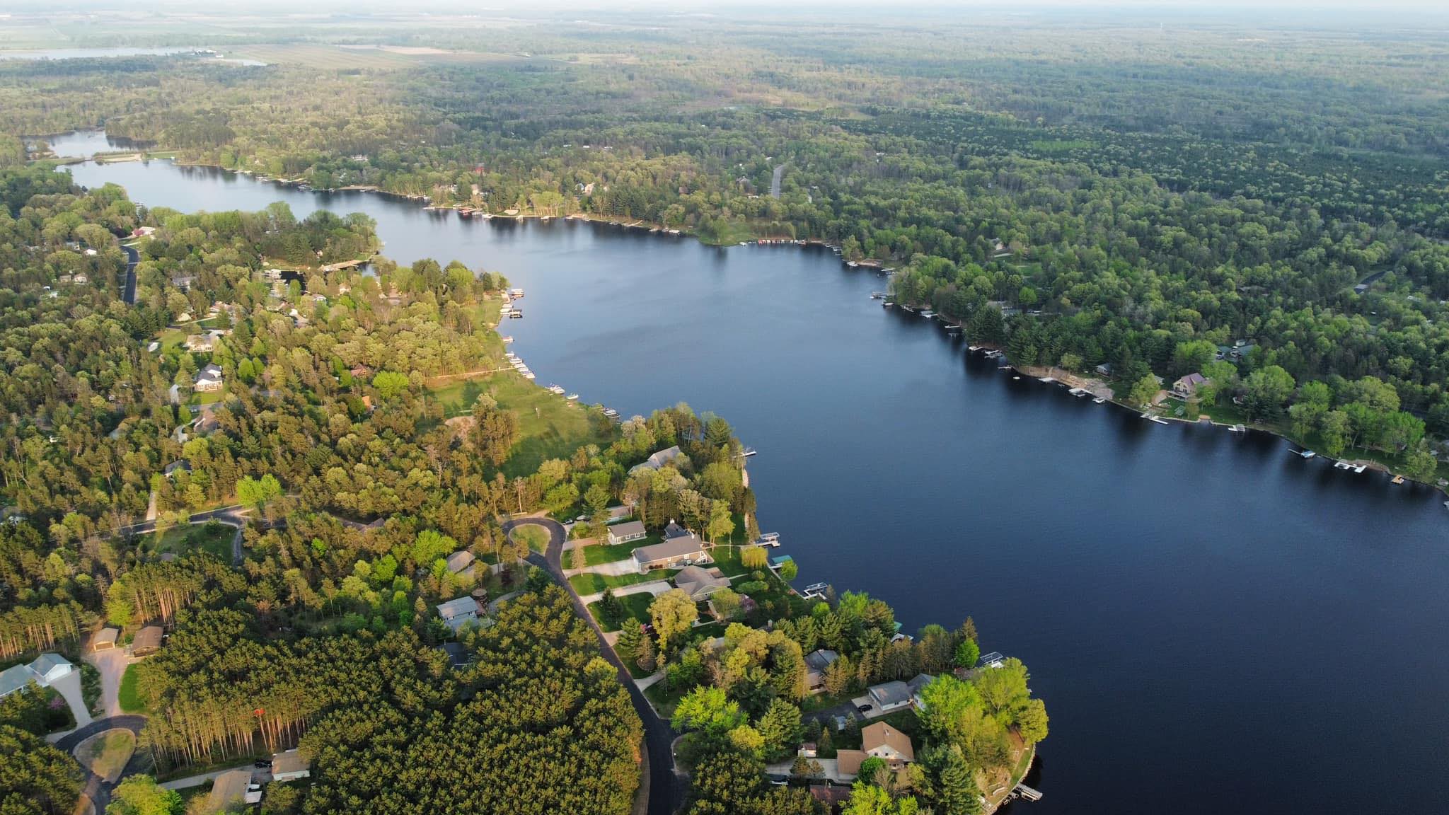

Real Estate
Drone photography has revolutionized real estate listings, offering unique perspectives that ground-level photography can't match. With drones, realtors can capture stunning aerial views of properties, showing the scale of the land, the layout of the home, and the context of the surrounding neighborhood.
This high-resolution imagery can significantly enhance property listings, providing potential buyers with a comprehensive visual understanding of the property. By vividly showcasing the unique features and true value of the property, drone photography helps attract more interest, encouraging faster sales and often at better prices.
Pricing
Our pricing structure varies depending on the project's scope and duration, with different structures for photogrammetry and recurring site mapping services. However, we maintain competitive pricing across all our services, including our base aerial photography offerings.
We offer basic drone photography services, ideal for real estate and other applications, starting at just $149.
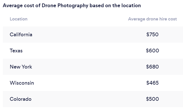
As illustrated by the following 2021 article, our pricing falls significantly below the state average. Importantly, this economical pricing doesn't imply a compromise on quality. Our 4K drones are equipped for HDR photography and video, and our pilots are highly skilled and certified.
Our commitment to providing exceptional value is reflected in our current pricing strategy. We have intentionally set our fees lower for our initial clients as part of our mission to refine and enhance the overall customer experience. This allows us to gather valuable feedback and data, and ultimately, to better serve you.